-

StickHelmet


 2023-09-12 15:44:09 UTC
 Operation: Lockdown
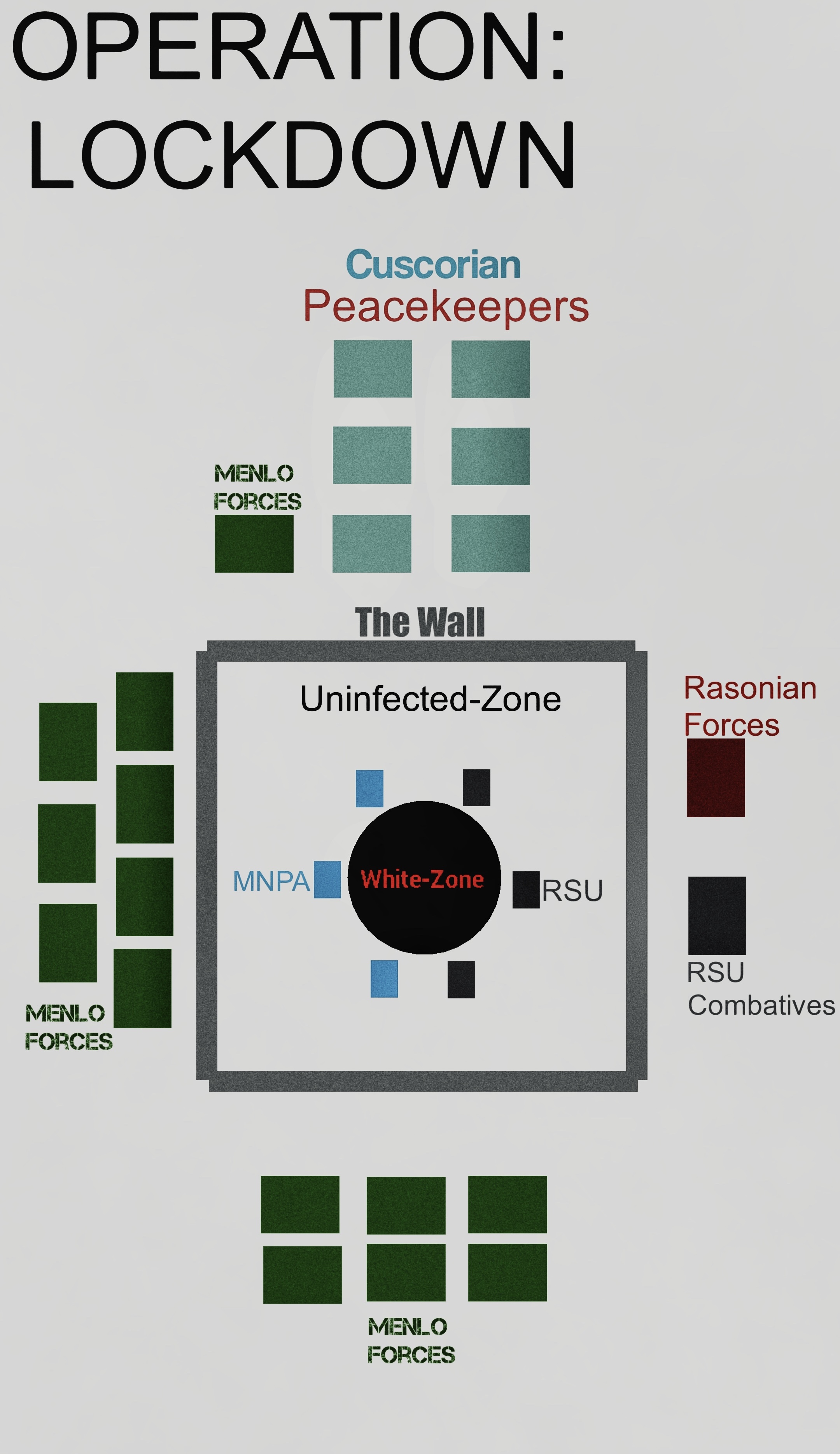
MGF, NDU, and RSU’s Evacuation Plan, taken place during the evacuation of part 3. I know it looks like a 3 year old made this but like, I can’t make a really detailed map of a city 😭This plan was to contain the virus and safely evacuate civilians as much as they can, unfortunately things took a bad turn.
First Image
One block is a Company Worth of soldiers (200 soldiers)West side (Left): mostly consists of the Menlo Ground Forces, which has 1,400 soldiers.
North Side (Top): Mostly Consists of the NDU, aka the Cuscorian Peacekeepers, having 1,200 Troops, 1,400 if the MGF besides them counts.
East Side (Right): only having Rasonia and RSU forces, making up 400 soldiers.
South Side (Bottom): 1,000 Menlo troops
Inside the City (Center): 1,200 if MNPA and RSU are mashed together, but both are 600
All in all, about 5400 soldiers.
Which is, really small compared to the population being 2 million 💀
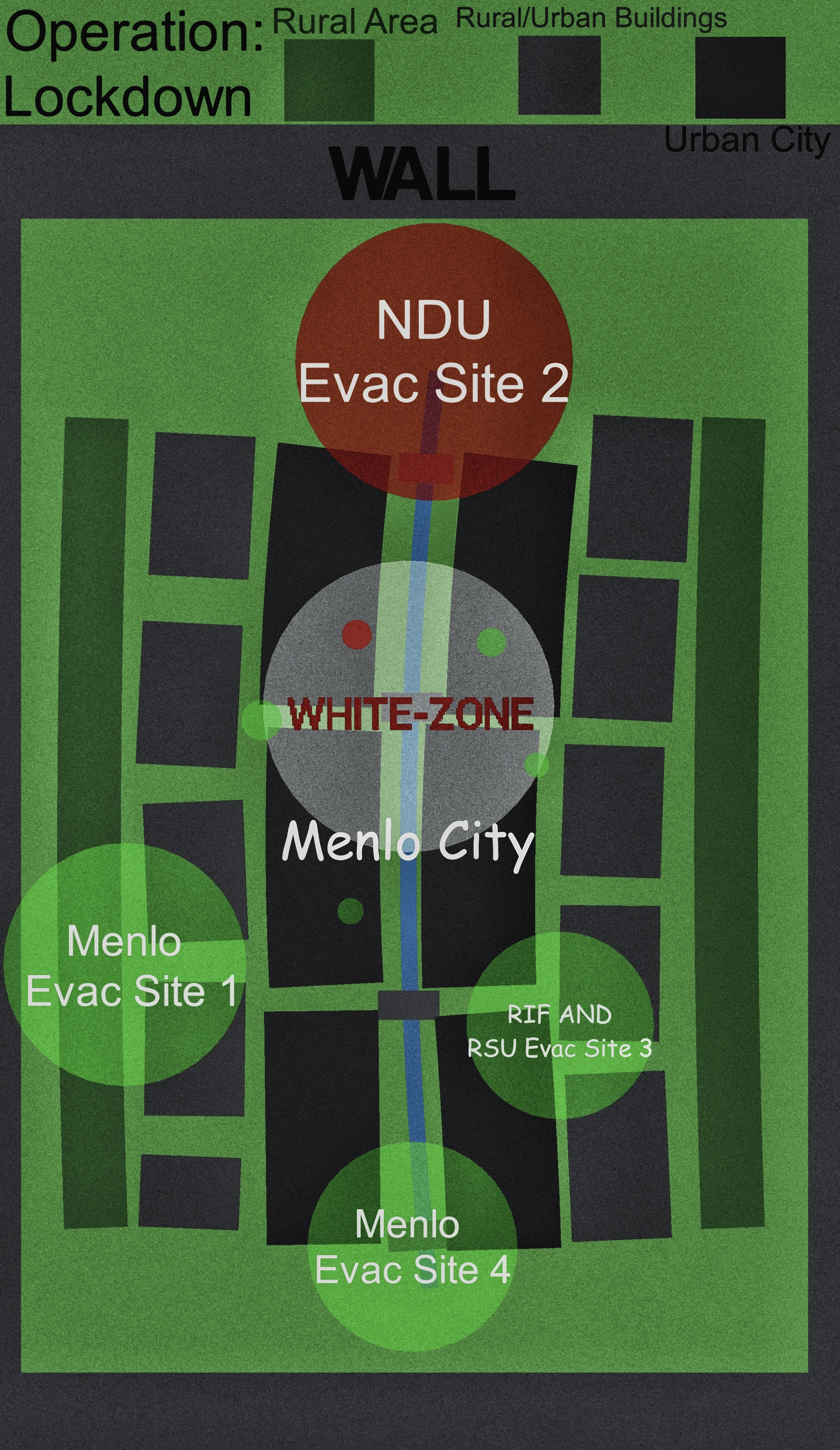
I should work better on numbers.Second Image
Inside the city, not very detailed but explains the needed information.Green Circles indicates Evac Points, areas controlled by military forces for civilians to get out of.
Red circles Are basically the same as the green one but are controlled by the NDU.
Smaller circles near or inside the White-Zone are small evac areas that can only take a small group, those areas are usually attended with a platoon with armored vehicles to helicopters, once evacuated. That area becomes the first line of defense if the zone begins to spread.
I might remake this, it isn’t perfect but it’s good enough.
Stick Nodes®
A stickfigure animation app created for mobile devices!
Create your own stickman animations on your Android or iOS device!


cool
I had such a fun time trying to fix and see if the things I changed would work (it didn’t.)
it Also made it worse